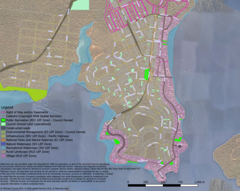
MidCoast Council staff have very kindly provided us with an updated zoning map of North Arm Cove, and a recent satellite image of the cove.
Both of these are attached to this post and can be downloaded.
The zoning map is quite detailed. It contains overlays on a satellite image showing:
- property and road boundaries. This includes the privately owned roads which are shown edged with a pink dashed line.
- road names
- land zoning
- recreation reserves
- properties owned by Council.
The key on this map which is located on the bottom left hand corner shows the meaning of the different colours on the map.
The satellite image is of the same area as the zoning map, but without any overlays.
The originals ofthese files were quite large (over 20mB each) so I had to reduce their size to less than 5mB to post them on the website.
Many thanks to Council's GIS Technician Engineering Transport Assets for providing us with these images.


